
The daffodils are out, the lambs are out, the bare arms are out… It must be spring! That means it’s also time to get those walking boots out of the cupboard they’ve been hiding in all winter, and head for Cumbria’s great outdoors.
Award-winning guidebook writer and photographer Vivienne Crow has come up with another superb selection of walks – all accessible by Stagecoach bus – that provide just a tiny taste of what the county has to offer. The routes range from an historic 90-minute town trail to more challenging hikes on the high fells.
For bus times, go to the Stagecoach website or download the Stagecoach Bus app from Google Play or Apple’s App Store. Pensioners travel free with a NoW card while everyone else pays only £3 per journey under the national fare-cap scheme.
Walk 1: Friar’s Crag & Castlehead
Bus route: Start from Keswick, served by Honister Ramblers 77, 77A, 77C, The Borrowdale Bus 78, 509, Route 553, 554, Lakes Connection 555, X4 & X5
Length/difficulty: 4¼ miles; easy; approximately 2 hours
Map: Ordnance Survey OL4, English Lakes NW
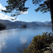
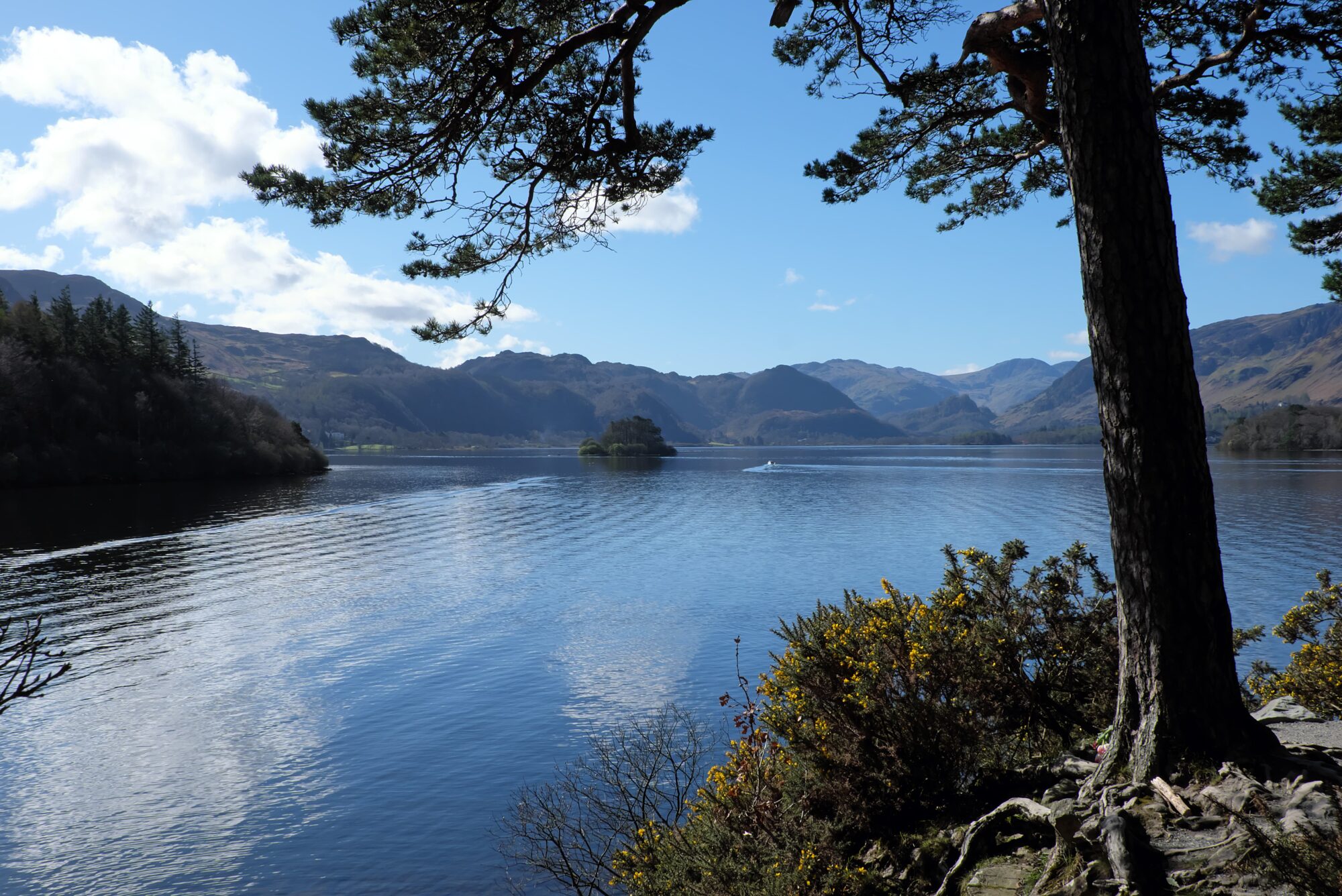
If you love the sparkle of the lakes, you’ll love this walk – a relatively easy amble that is dominated by Derwentwater. It starts by heading out from Keswick, along a popular shore path, to Friar’s Crag with its view down the lake and into the wooded Jaws of Borrowdale.
If the bench here is free, this might be the end of the walk for you; it’s hard to tear yourself away from that scene. Usually though, the bench is occupied, so you’ll press on… Along the lakeshore, in and out of trees that are showing signs of spring, to Calfclose Bay.
From here, the walk climbs through Great Wood, last year named one of the new King’s Series of National Nature Reserves. Glimpses of the water come and go before the route drops back towards Keswick. Before finishing though, there’s one more chance of a view of this beautiful lake, this time from the top of little Castlehead. And there are more benches here to tempt you to linger…
Walk 2: Dodd

Bus route: X4, Route 553 & 554 to Dodd Wood
Length/difficulty: 3½ miles; moderate; approximately 2¼ hours
Map: Ordnance Survey OL4, English Lakes NW
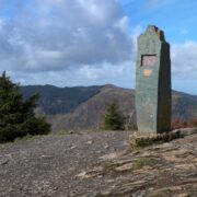
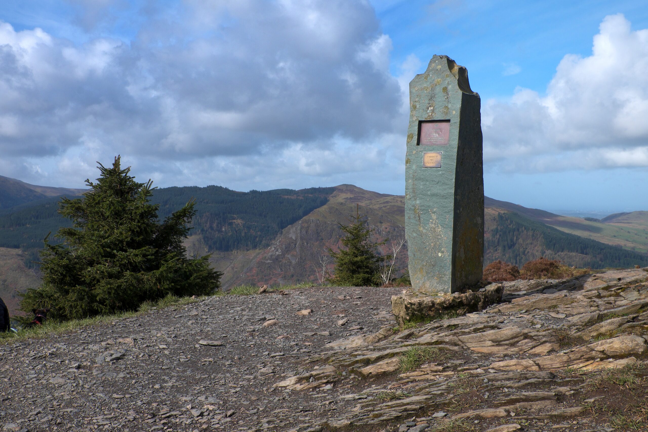
In Lakeland terms, Dodd’s really just a small fell and, squatting at the foot of England’s fourth highest mountain, it seems even more insignificant. But reaching its 1,647ft (502m) summit almost from lake level will put climbing muscles to the test, particularly those that haven’t seen much action over the winter.
With no messing about, the path sets off from behind the Old Sawmill Tearoom and immediately begins ascending. It’s a short, sharp pull to the top, but the rewards are worth it. Since the summit was cleared of trees several years ago, Dodd has provided superb views of the north-western Lake District and across the Solway Firth into Dumfries & Galloway.
The descent is slightly gentler, allowing more opportunities to relax and enjoy the woodland and its birdlife. Those carrying binoculars might want to train them on Bassenthwaite Lake where the local ospreys fish. They return to the area in the spring, having spent winter in warmer climes.
Walk 3: Goat’s Water Round
Bus route: Route 505 to Coniston
Length/difficulty: 8 miles; hard; approximately 5 hours
Map: Ordnance Survey OL6, English Lakes SW
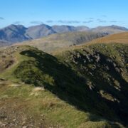
The outlook from the southernmost Coniston Fells is truly breathtaking, taking in the Pennines, the Duddon estuary, Morecambe Bay, the Scafell group, the Isle of Man and, on the clearest of days, even Eryri (Snowdonia) in Wales.
Setting off from Coniston, served by the 505 bus, the group can be approached using the Walna Scar Road, a rough track climbing steadily from the western side of the village. Brown Pike, Buck Pike and the rocky Dow Crag, reached via some easy scrambling, are the first summits on the round.
After dropping to the pass at Goat’s Hawse, the route climbs again and swings up on to the Old Man – at 2,634ft (803m), the highest point on the walk. From here, the well-trodden ‘tourist path’ drops past lovely Low Water and through fascinating old quarry and mine workings to return to Coniston and the chance to grab something to eat in one of the village’s many pubs and cafés.
Walk 4: Whitehaven harbour & shore
Bus route: Start from Whitehaven, served by buses 2, 2A, 3, 3A, 29, 29A and 30
Length/difficulty: 3 miles; easy; approximately 1½ hours
Map: Ordnance Survey Explorer 303
Cumbria isn’t just about the Lake District; our fascinating county has lots more to offer. Whitehaven, for example, might not jump out as a walkers’ destination but you might be surprised at just how rewarding it can be to while away a few hours in this coastal town.
Start by having a little wander down by the attractive harbour area, which has benefitted from millions of pounds in grants in the last few decades, improving public access to the marina. The Beacon Museum (closed Mondays) is worth a visit if you’ve got time.
Now follow the England Coast Path south, up past the Candlestick, and on to low cliffs that enjoy good views up the coast and into Scotland. Returning to the town later, Georgian townhouses act as reminders of Whitehaven’s transition from simple fishing village to England’s third largest port in the 17th century.
The Rum Story, on Lowther Street, tells the story of the town and, in particular, the role that the trade in rum and slaves played in its early development.
Walk 5: Solway Coast (linear from Allonby to Silloth)

Bus route: both Allonby and Silloth are served by bus 60 (Silloth is also served by route 400 from Carlisle)
Length/difficulty: 8¼ miles; easy; approximately 3¼ hours
Map: Ordnance Survey Explorer 314, Solway Firth
Further north along the coast, you’ll find one of the county’s three National Landscapes – the Solway Coast. Stretching from just north of Maryport to Rockcliffe near Carlisle, this takes in a variety of important habitats including salt marsh, sand dunes and peat bog.
The long beaches and low dunes of the south-western part of the National Landscape can be explored on a linear walk between the seaside settlements of Allonby and Silloth, linked by the number 60 bus. The tide goes out some way here – so much so that it looks like you could practically walk across to Scotland on the other side of the water.
You can’t, but you can wander on the exposed shore. If you’re lucky, you might even stumble across a submerged forest near Beckfoot – the branches and stumps of trees that lived here 8,000 years ago sometimes emerge from the sand and mud. Visit on a spring evening and there’s also a chance of hearing rare natterjack toads calling to potential mates.
Walk 6: Hadrian’s Wall and Birdoswald Fort
Bus route: start from the Gap Shield bus stop on the A69, served by the 685
Length/difficulty: 9 miles; easy/moderate; approximately 4 hours
Map: Ordnance Survey OL43, Hadrian’s Wall
The Hadrian’s Wall Path National Trail passes to the north of the Lake District National Park, with its western terminus at Bowness-on-Solway. There’s little to be seen of the Roman remains at Bowness, but the longest continuous stretch of the wall still standing can be seen further east, at Birdoswald.
To walk this section of the National Trail, catch the 685 bus from Carlisle or Brampton and ask the driver to drop you at Gap Shield on the A69. A quiet road leads down to Gilsland where the Hadrian’s Wall Path can be joined.
Heading west, a Roman turret is passed, as are the remains of the bridge over the River Irthing. Beyond Birdoswald Fort (open daily from the beginning of April), continue on the Hadrian’s Wall Path for just over a mile and then drop to recross the Irthing via a small suspension bridge near Lanerton. From here, country roads can be followed back up to the A69 to return to the bus stop.
Walk 7: Angle Tarn
Bus route: 508 & 509 to Patterdale
Length/difficulty: 7½ miles; moderate; approximately 4¼ hours
Map: Ordnance Survey OL5, English Lakes NE
Angle Tarn is exquisitely located at 1,571ft (479m) above sea level, tucked into a grassy hollow at the base of Angletarn Pikes. The walk up to it is superb: not only does it provide great views, particularly across to the Helvellyn and Fairfield ranges, there’s also a good chance of spotting the red deer that roam freely on these hills.
Starting from Patterdale, served by the 508 bus, the walk follows valley paths as far as Hartsop. From here, the climb begins… gently at first, beside the tumbling waterfalls of Hayeswater Gill, and then more steeply. Beyond Hayeswater, walkers join the route of Wainwright’s Coast to Coast walk to reach a high point near Satura Crag.
From here, the well-trodden path drops to Angle Tarn and then hugs the side of the fell in spectacular fashion before continuing downhill to Boredale Hause. Finally, still descending, the trail leads back into the valley where lambs leap about in the beckside meadows.
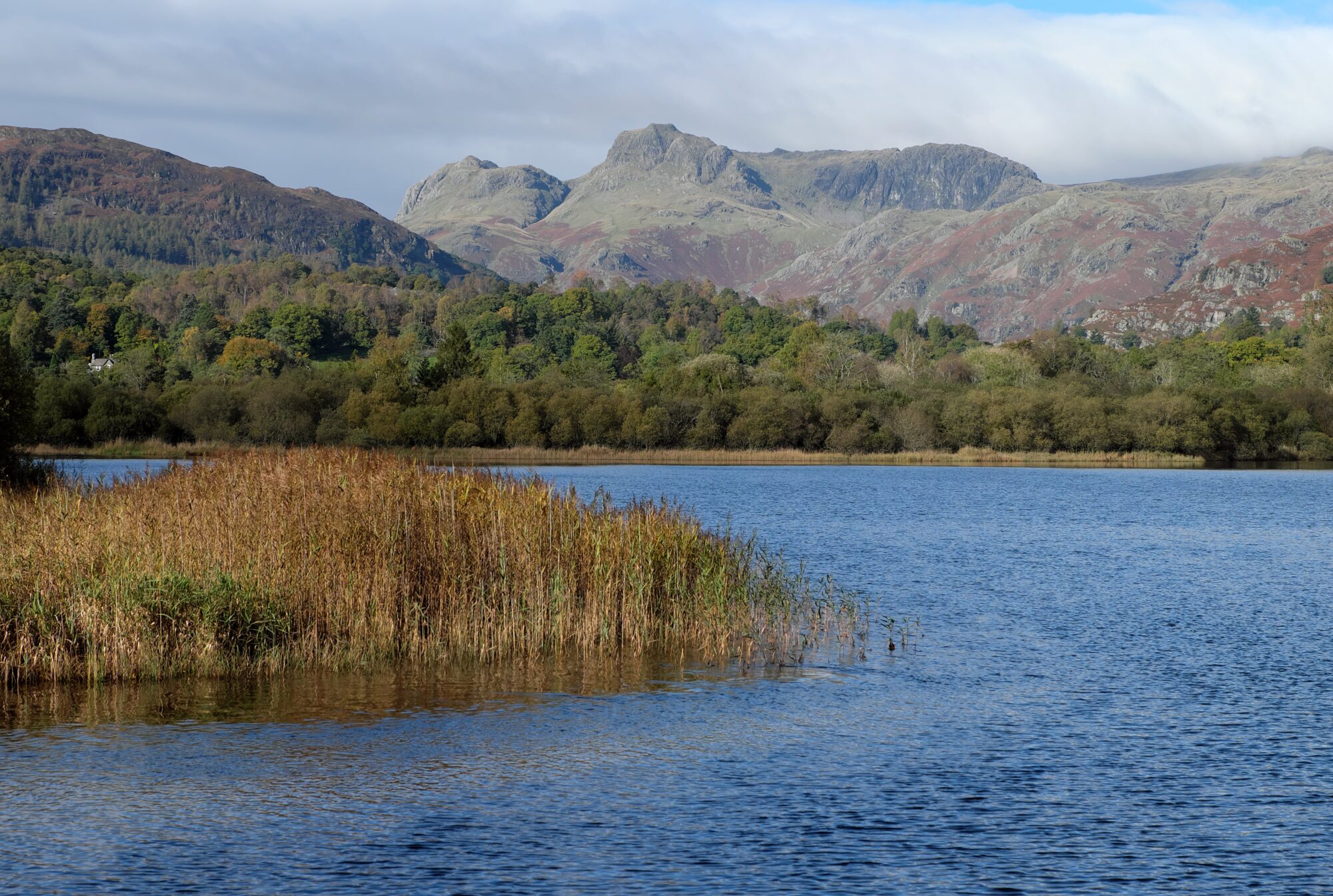
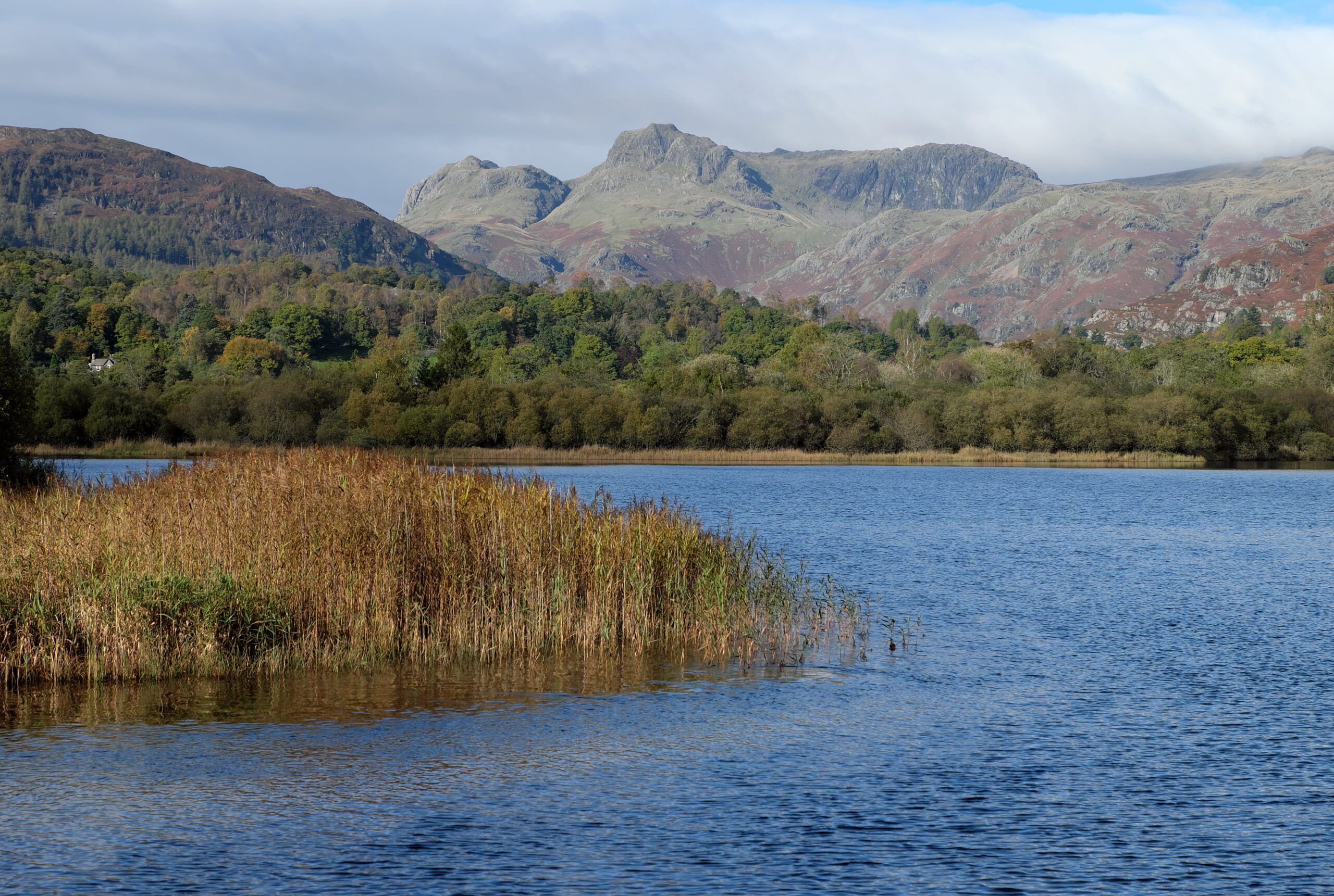
Walk 8: Langdale Pikes
Bus route: 516 to New Dungeon Ghyll, Great Langdale
Length/difficulty: 8 miles; hard; approximately 5½ hours
Map: Ordnance Survey OL6, English Lakes SW
The Langdale Pikes are among the best-known peaks in the Lake District. You might not know their individual names, but their distinctive profiles are easily recognised even from a distance. The most popular path from Great Langdale on to the high ground starts at the New Dungeon Ghyll, served by the 516 bus from Ambleside.
From here, Stickle Ghyll is climbed to reach Stickle Tarn at the foot of Pavey Ark’s magnificent cliffs. Climbers and scramblers will find vertiginous routes up the rock face; lesser mortals use less hair-raising paths. From the top, other pikes can be bagged, including Harrison Stickle (at 2,414ft/736m, the highest of the bunch), Loft Crag and Pike o’ Stickle.
Steep paths drop from the pikes directly back to Great Langdale. To complete a more satisfying, eight-mile route, head north-west on to peaty Martcrag Moor and then descend Stake Gill. The day ends with easy track walking along the floor of the Mickleden valley, flanked on either side by steep, rugged slopes.
Walk 9: Robinson (linear from Hawse End to Buttermere)

Bus route: both Hawse End and Buttermere are served by The Honister Ramblers 77, 77A and 77C
Length/difficulty: 7¼ miles; hard; approximately 5 hours
Map: Ordnance Survey OL4, English Lakes NW
The 77/77A/77C buses, which resume service from March 31, open up all sorts of opportunities for linear routes in the north-west of the National Park – valley walks as well as hikes on the fells. This walk combines the best of both worlds, starting on low-level tracks and trails that lead up into a little-visited side valley before climbing to the high ground.
Setting off from the bus stop near Hawse End, it skirts the base of Cat Bells and then heads past intriguing Elizabethan mine workings to enter Little Dale. The path ends as it nears the valley head, so decent map-reading skills are essential to continue from here to the top of Robinson (2,417ft/737m).
After enjoying far-reaching views from the summit plateau, the descent to Buttermere is via Buttermere Moss and an old peat road that eases its winding way down the fellside. And, if you’re too early for your bus back, take your pick from one of several cafés and pubs in the village.
Walk 10: Scandale
Bus route: Start from Ambleside, served by buses Lakes Connection 555, Lakesider 599, 516 and Route 505
Length/difficulty: 3 miles; easy; approximately 1¾ hours
Map: Ordnance Survey OL7, English Lakes SE
Scandale is a narrow valley squeezed between the eastern arm of the Fairfield Horseshoe and the ridge that culminates in Red Screes. Easily reached from busy Ambleside on an old drove road, it has a surprisingly ‘wild’ feel to it.
Climbing gradually, the track passes through lovely woodland that is full of birdsong at this time of year. Beyond the trees, the sound of the birds is replaced by the whoosh of the beck as it speeds through the steep-sided gorge.
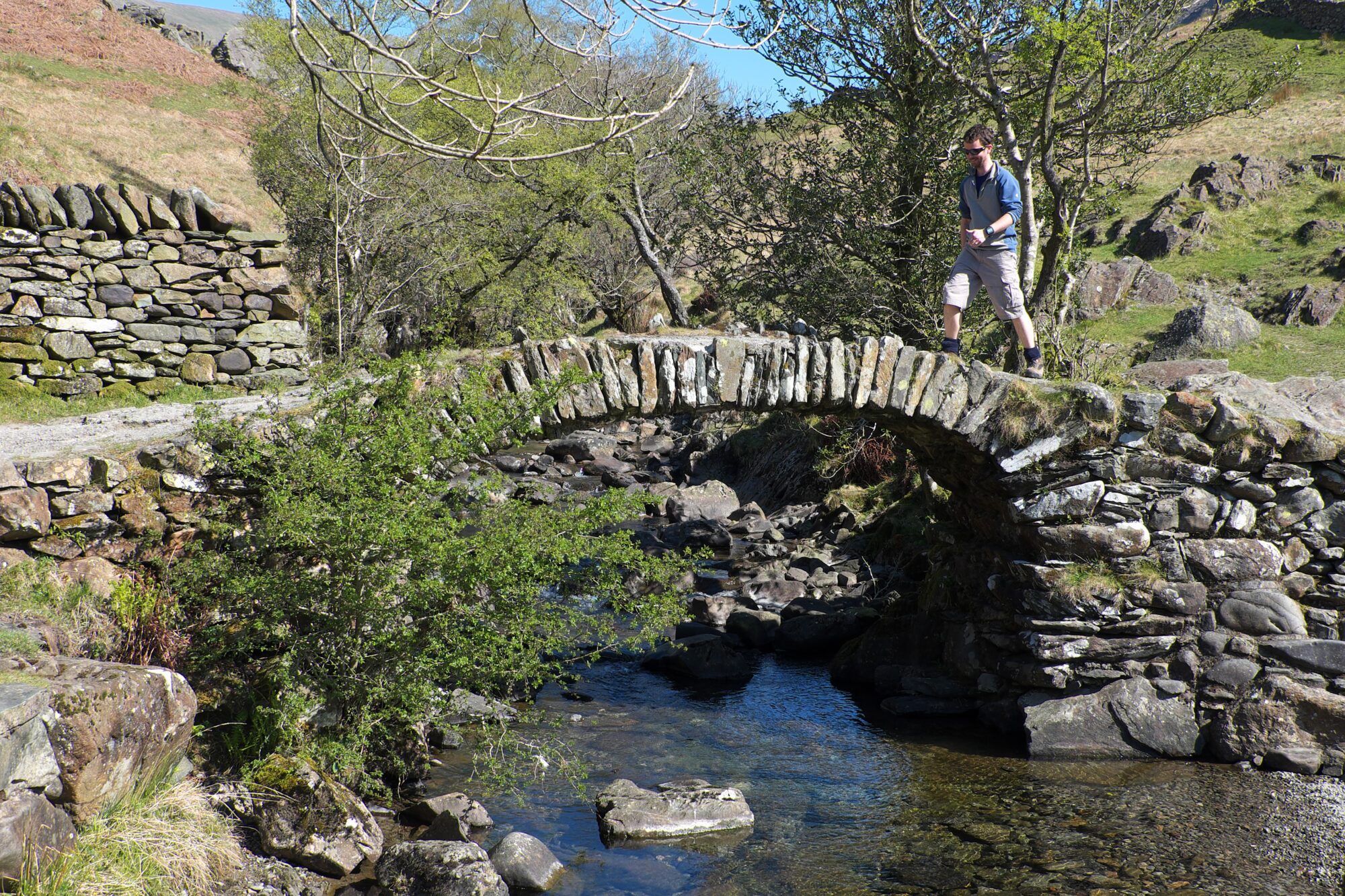
The highlight comes about half-way through the walk when High Sweden Bridge is crossed. This is one of the loveliest of the centuries-old packhorse bridges found throughout Lakeland. These were built for the packhorse trains that used to transport goods such as wool, slate, timber and even lead across the fells. Because the ponies carried huge, bulky loads, the bridges were built without parapets to allow them to pass unhindered, so keep tight hold of children’s hands as you cross.
The Langdale Pikes are easily recognised from a distance PICTURE CREDIT: VIVIENNE CROW (For one use only)
© Vivienne Crow

Looking up Derwentwater from Friar's Crag PICTURE CREDIT: VIVIENNE CROW (For one use only)
© Vivienne Crow
The memorial on Dodd's summit PICTURE CREDIT: VIVIENNE CROW (For one use only)
© Vivienne Crow
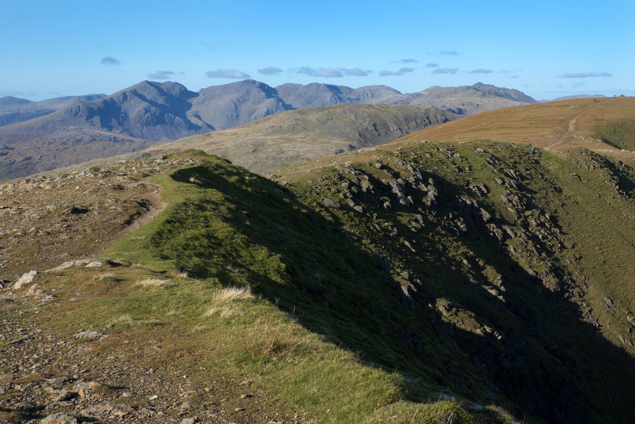
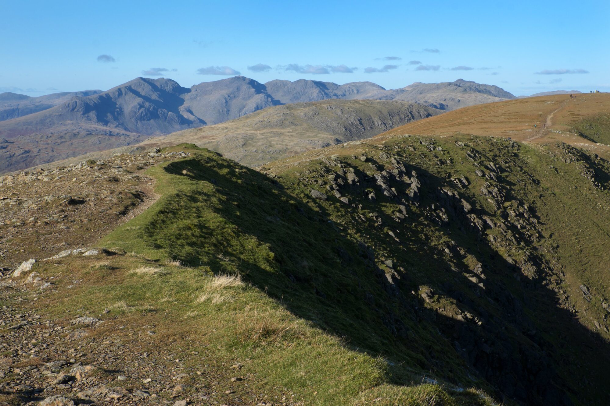
The Scafells from the Old Man PICTURE CREDIT: VIVIENNE CROW (For one use only)
© Vivienne Crow

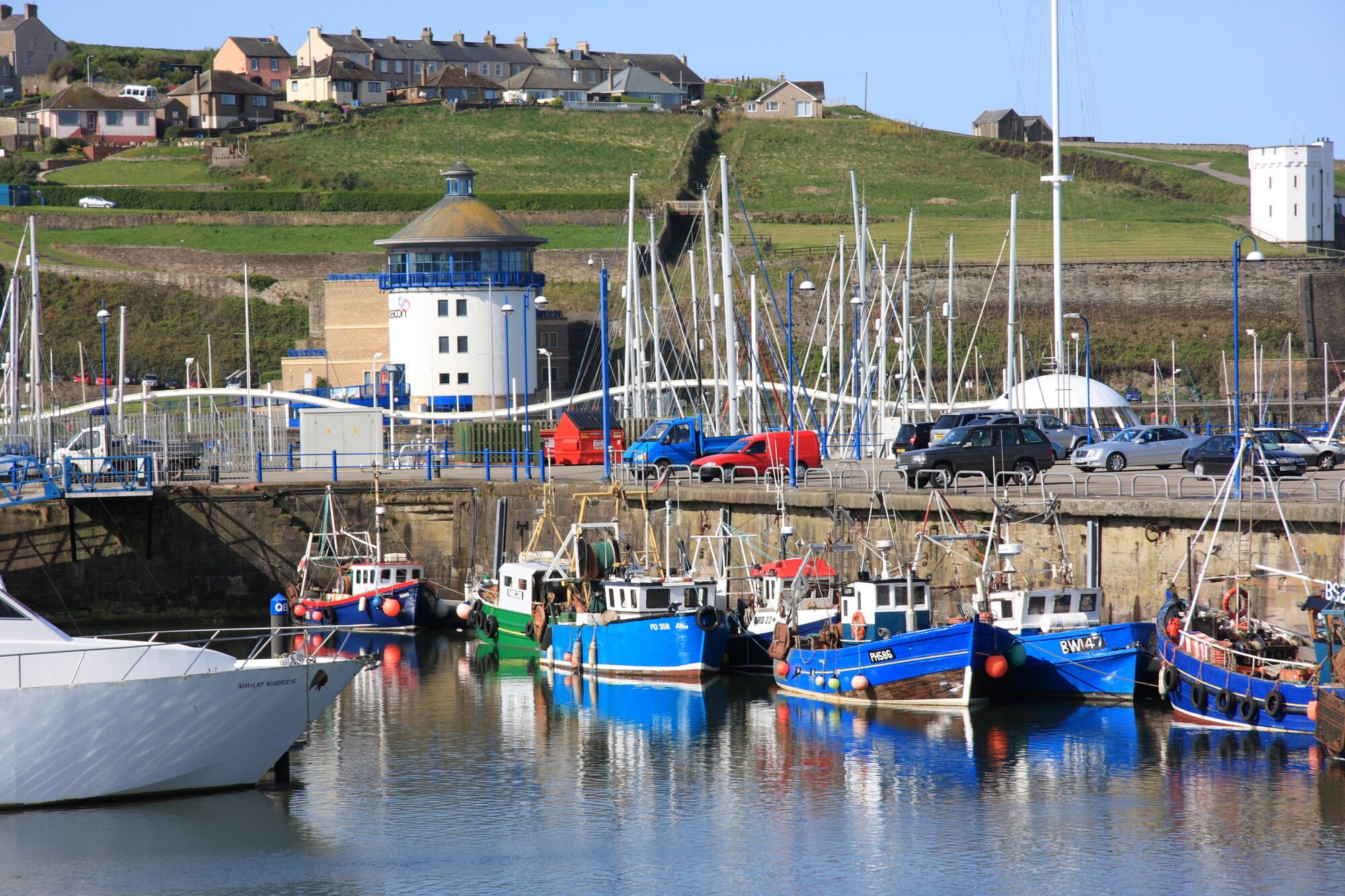
Whitehaven Harbour PICTURE CREDIT: VIVIENNE CROW (For one use only)
© Vivienne Crow
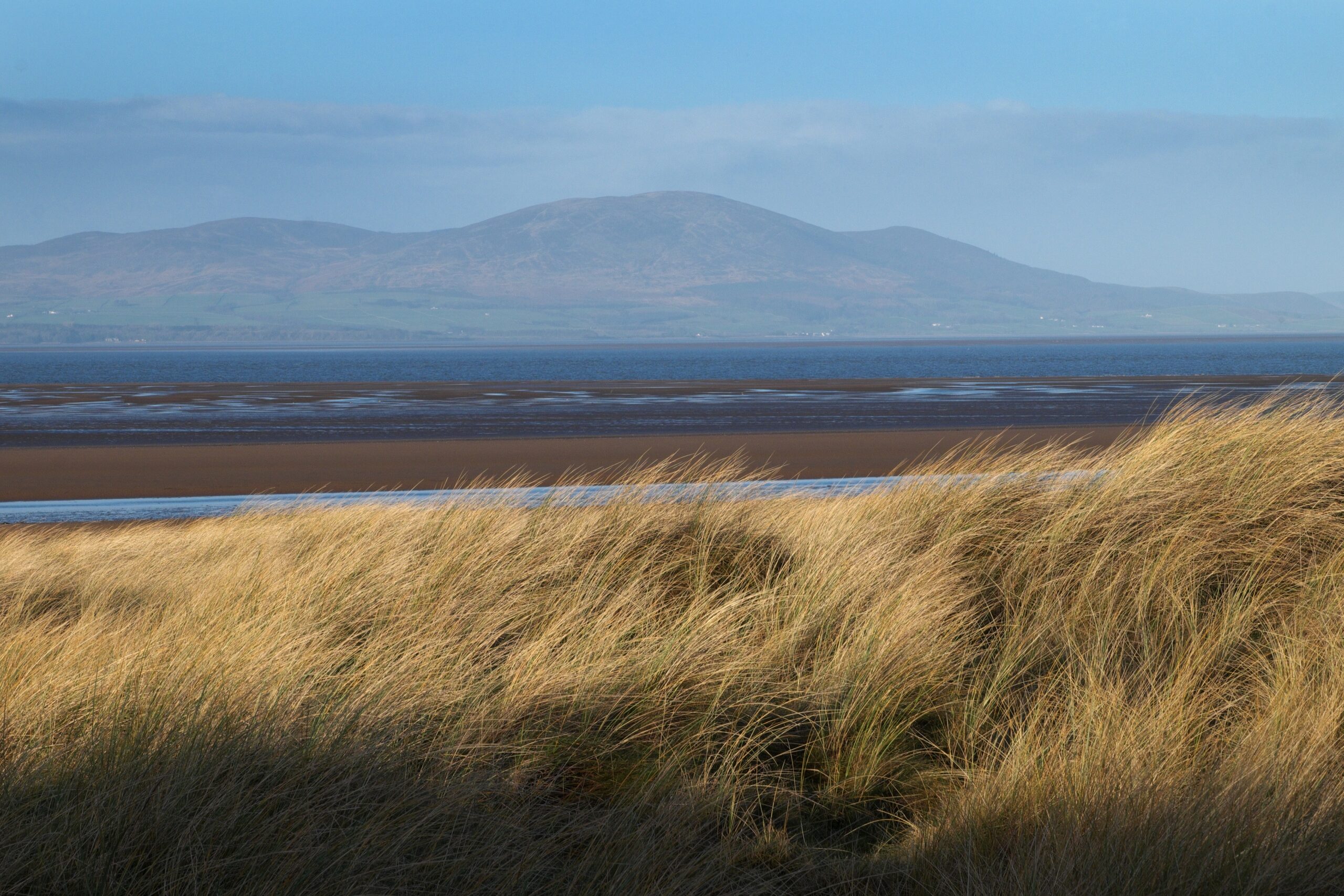
Looking across the Solway Firth to Criffel PICTURE CREDIT: VIVIENNE CROW (For one use only)
© Vivienne Crow

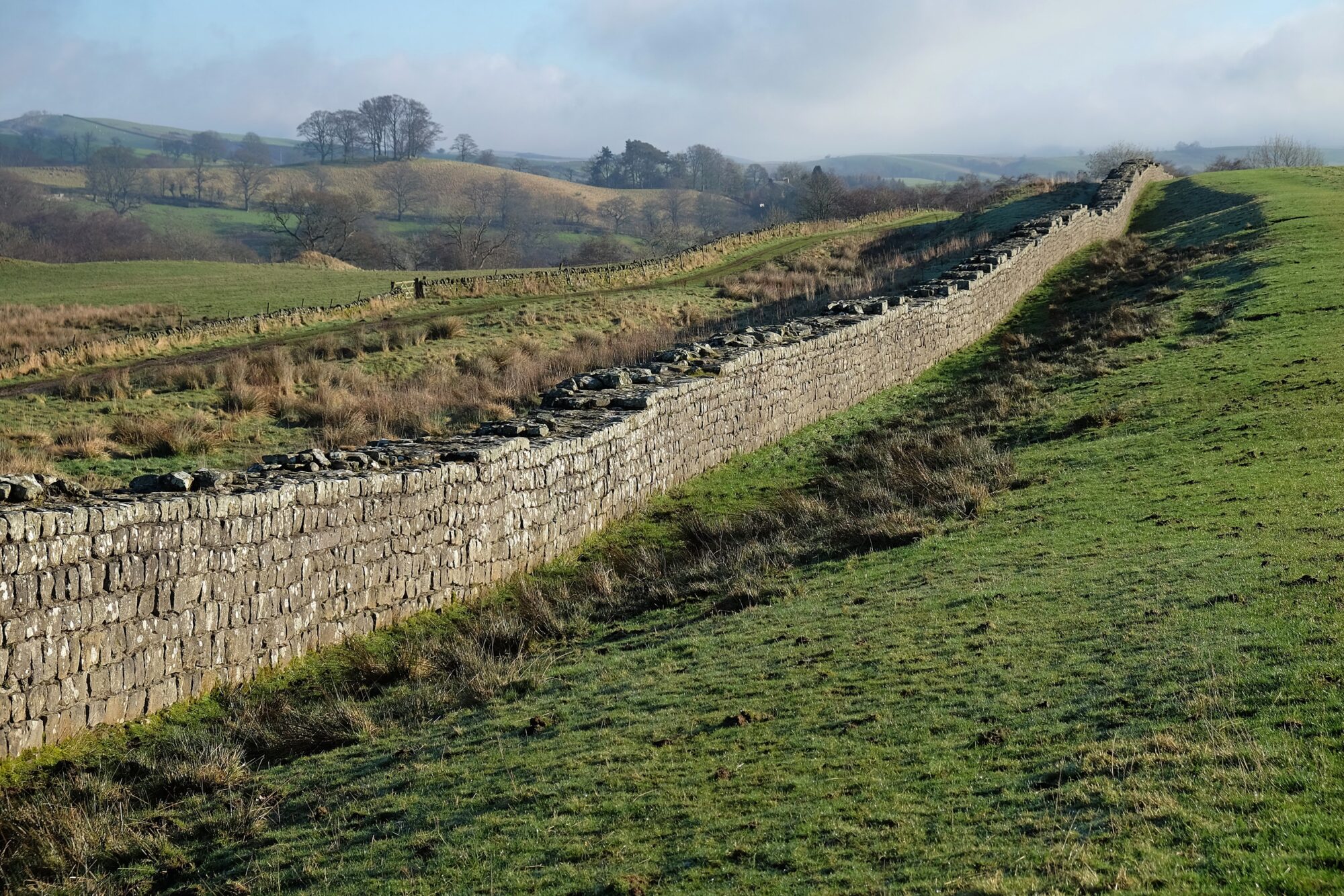
Hadrians Wall at Birdoswald PICTURE CREDIT: VIVIENNE CROW (For one use only)
© Vivienne Crow

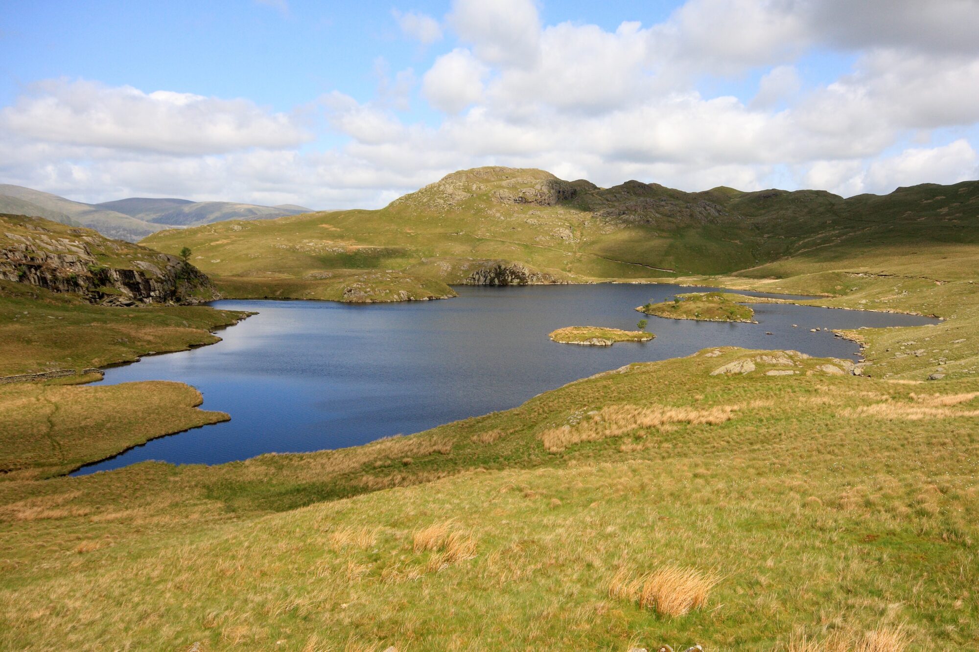
Angle Tarn PICTURE CREDIT: VIVIENNE CROW (For one use only)
© Vivienne Crow
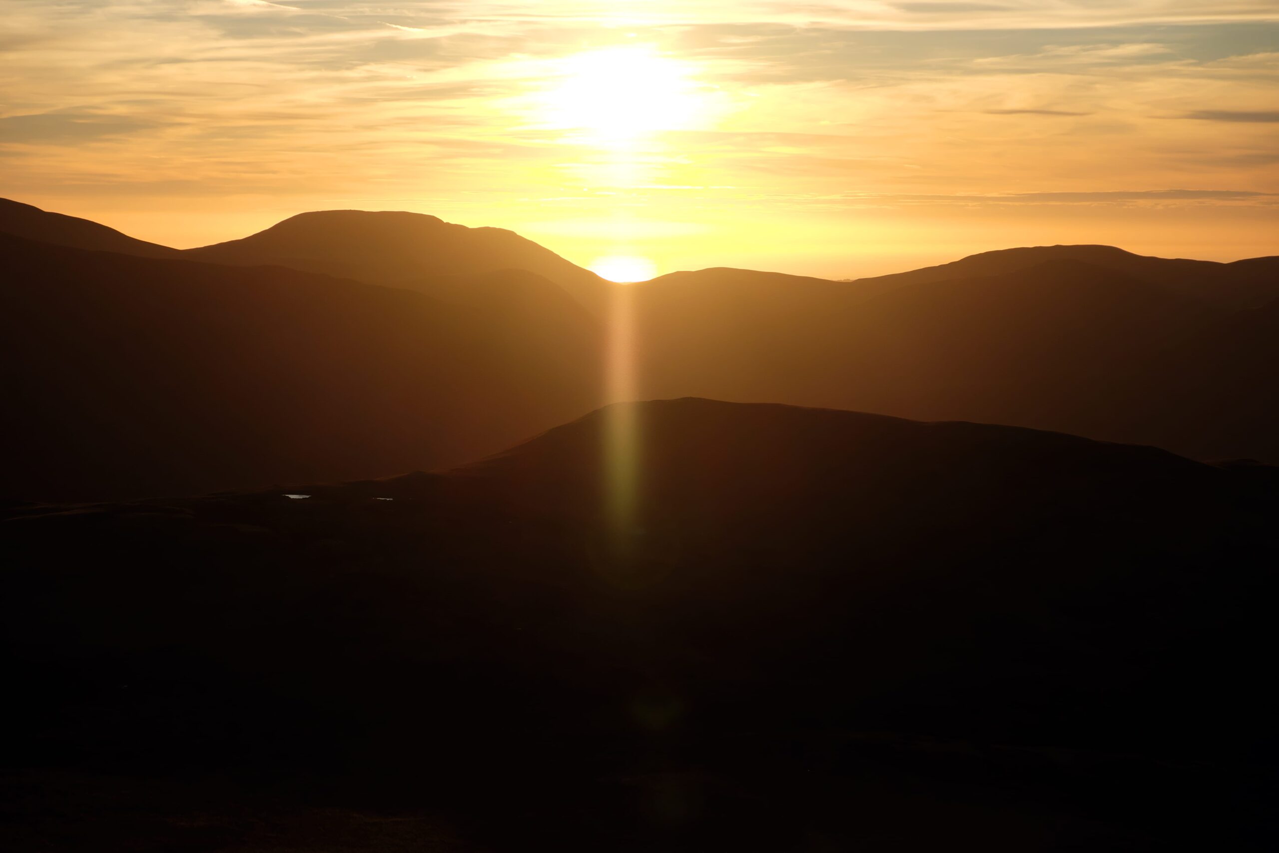
Sunset from Robinson PICTURE CREDIT: VIVIENNE CROW (For one use only)
© Vivienne Crow

High Sweden Bridge PICTURE CREDIT: VIVIENNE CROW (For one use only)
© Vivienne Crow