
After winter’s pallor, the landscape of Cumbria and the Lake District regains its colour in spring.
The change begins with a few wildflowers, including daffodils and bluebells, before gradually moving to the leaves on the trees and then the fells. It’s a beautiful time to be wandering the county’s paths and enjoying nature at its invigorating best. And if you leave the car at home, you also have the satisfaction of knowing you’re doing your bit to help preserve the natural environment.
Award-winning writer and photographer, Vivienne Crow, has come up with a selection of 10 of the best springtime walks and all are accessible by catching a Stagecoach bus. Perfect for a car-free adventure.
From easy-going, low-level routes to the high fells and everything in between, these walks will help you get the most from the Cumbrian countryside at this time of the year.
Walk 1: Rannerdale’s bluebells
Bus route: Lakes Connection 77/77A, from Keswick to Buttermere or 77C, Cockermouth to Buttermere
Length or difficulty: 4½ miles; easy/ moderate; approximately 3 hours
Map: Ordnance Survey OL4, English Lakes NW
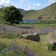
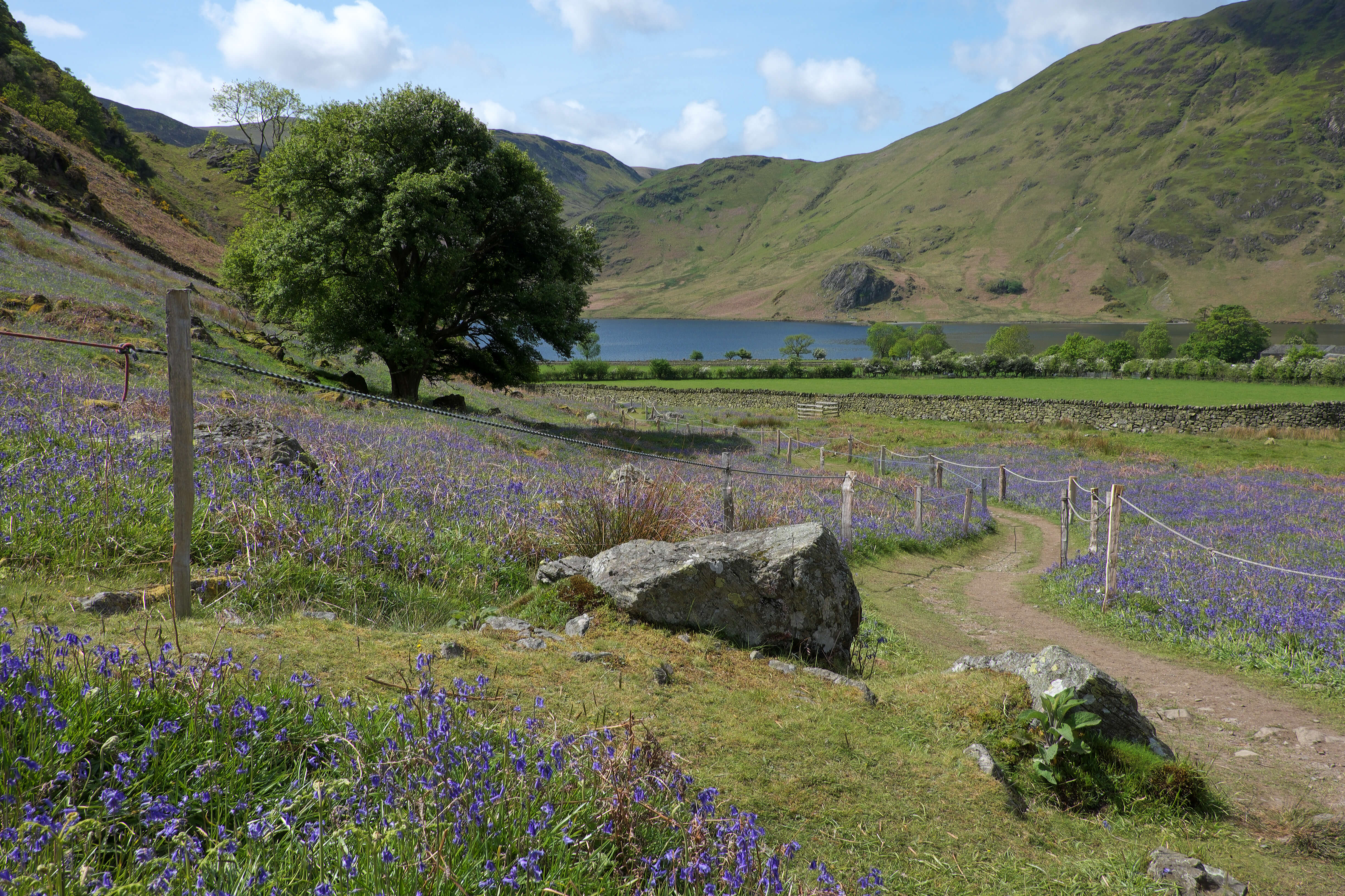
Catch it at the right moment in late April or early May, and Rannerdale is a sea of glorious blue. From the bus stop in Buttermere, make your way through the main car park and then down to the serene shores of Crummock Water for a short lakeside stroll. After following a grassy terrace path along Rannerdale Knotts’ southern flank – with stunning lake views – it’s quite a surprise to drop into the lonely valley filled with the sweet scent of bluebells, a wildflower normally associated with woodland. (Please keep to the fenced pathways to avoid trampling these delicate blooms).
Beyond the bluebells, a slow, steady climb to the head of Rannerdale leaves you with a choice: you can either drop straight back into Buttermere, cutting almost a mile off the total distance, or you can stride out along the grassy ridge to the top of Rannerdale Knotts for a more rousing finale.
Walk 2: High Rigg
Bus route: Lakes Connection 555 to Dale Bottom on the A591, 3 miles south-east of Keswick
Length or difficulty: 6¾ miles; moderate; approximately 4¼ hours
Map: Ordnance Survey OL5, English Lakes NE
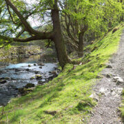
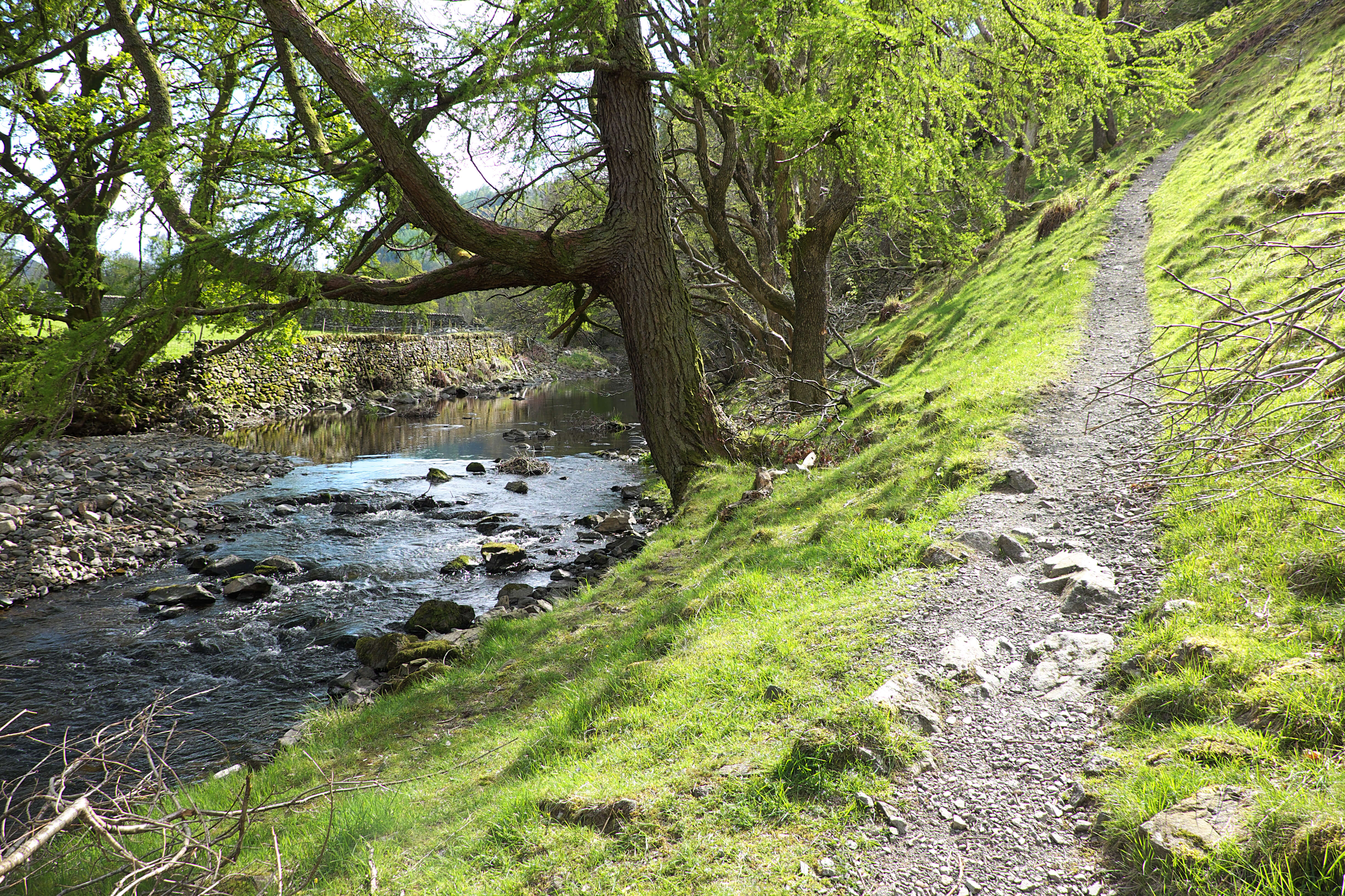
High Rigg has lots to offer for relatively little effort: hidden tarns, dark crags, springs and becks galore, knobbly summits, even a short section of narrow, heather-covered ridge. With lots of variety and any climbs short-lived, this walk is a great introduction to fell-walking for younger or less experienced hikers. Catch the 555 bus and ask the driver to drop you at Dale Bottom. From here, head across the farmland to the western base of this little, standalone fell. A grassy path climbs from near St John’s Church to the 1,171ft (357m) summit where views take in Blencathra, Skiddaw and the Helvellyn range. Meander south along the ridge before dropping through an area of Scots pines to St John’s Beck. A valley path heads north from here, passing the tea garden at Low Bridge End Farm before returning you to the church from where you retrace your steps to the bus stop on the A591.
Walk 3: Dent
Bus route: 30 to Egremont Main Street
Length or difficulty: 7¼ miles; moderate; approximately 4¼ hours
Map: Ordnance Survey OL4, English Lakes NW
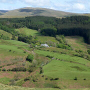
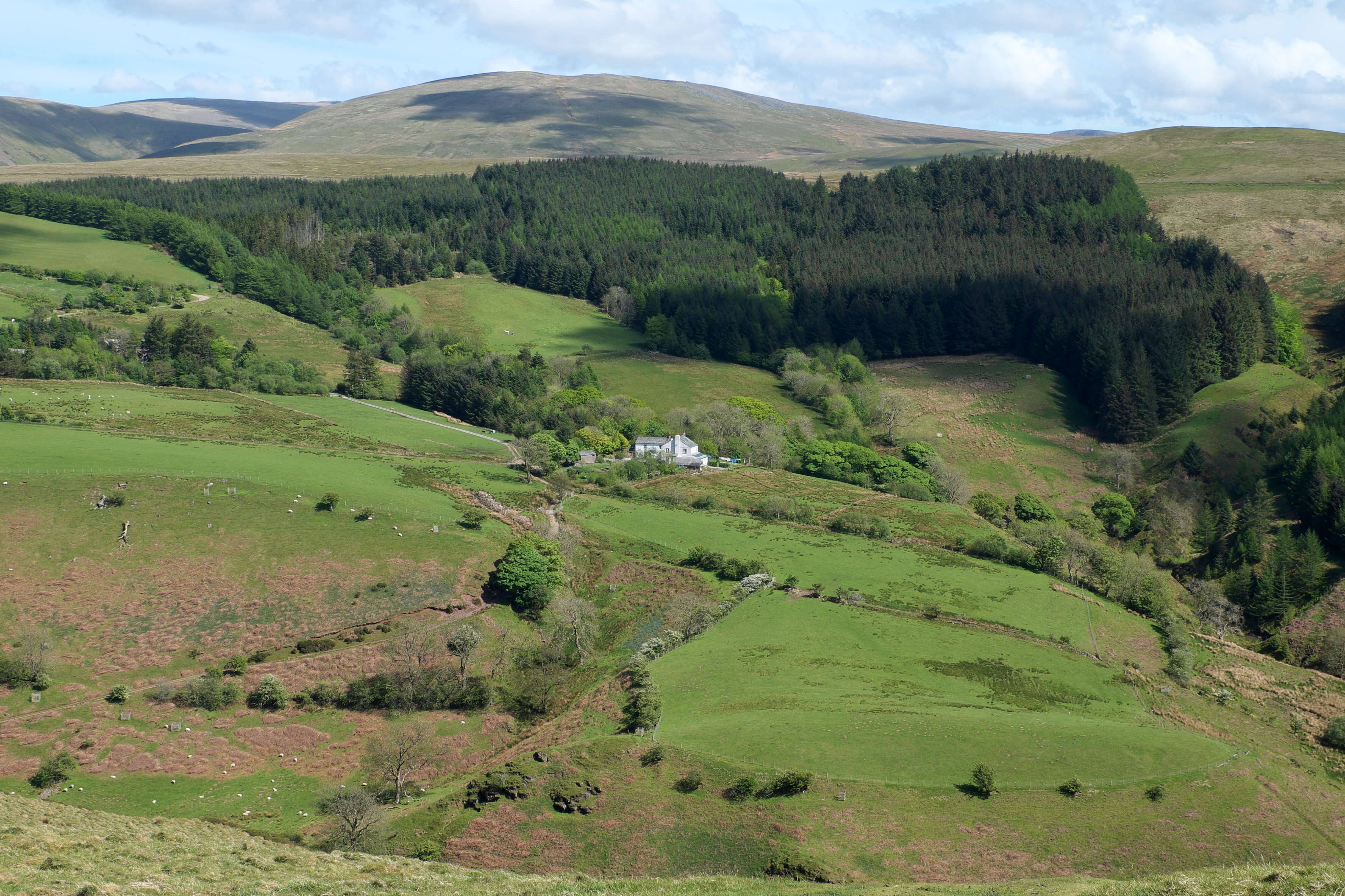
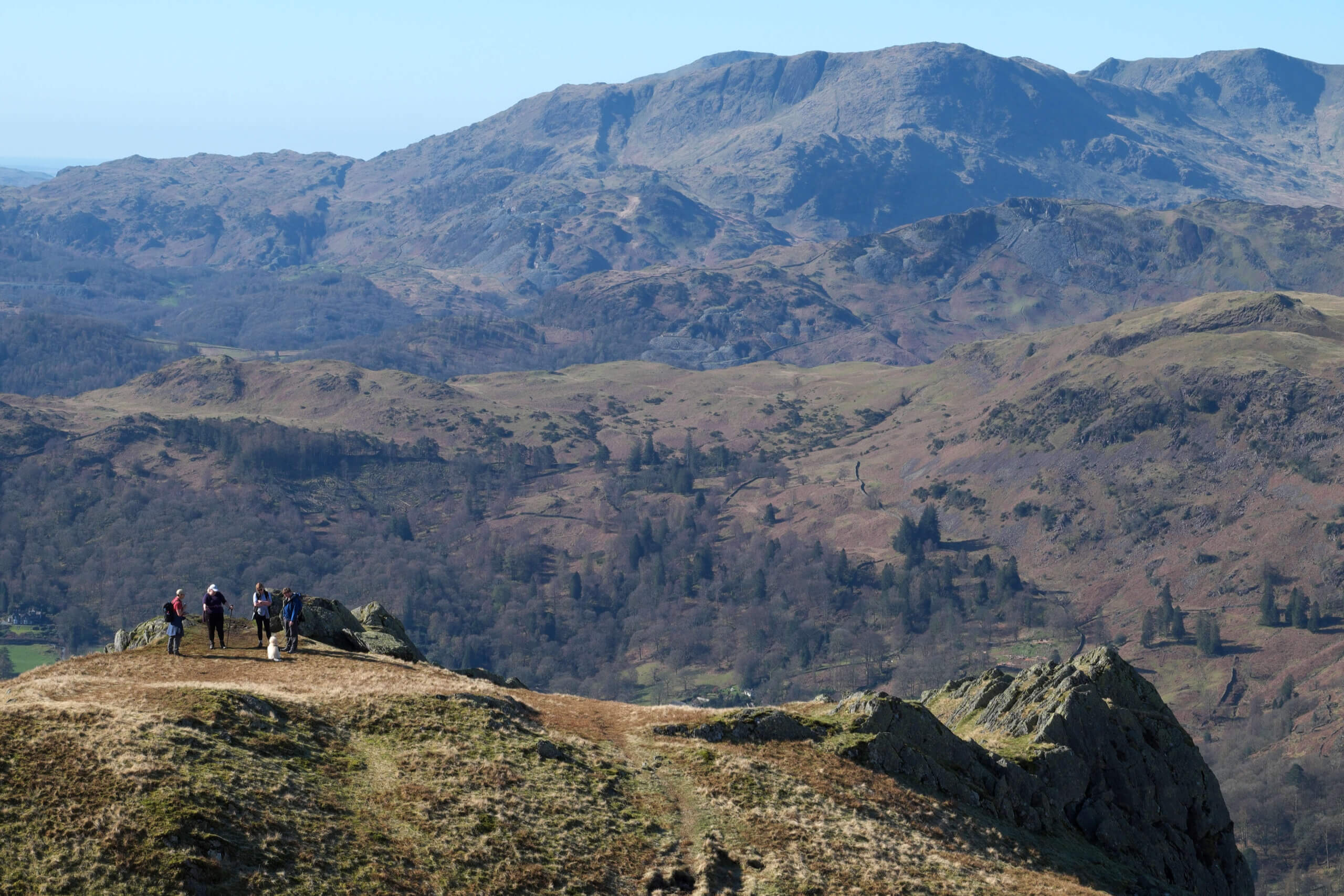
Dent, a former deer park, lies just outside the boundaries of the Lake District National Park, and yet the outlook from its 1,155ft (352m) summit is as magnificent as any in the Western Lakes. It’s the first summit on Wainwright’s famous Coast to Coast, giving long-distance hikers on their way from St Bees to Robin Hood’s Bay a taste of the spectacular fells to come as well as far-reaching sea views. This walk, starting from Egremont’s Main Street, follows a series of quiet lanes and stony tracks to the edge of the Lowther Park forests and then up into the hidden valley of Nannycatch. After this gentle start to the day, there’s a short, but punishing climb to the grassy summit, using the route of the Coast to Coast route in reverse. A steady descent on grass and then through the forest ensues before the walk finishes with a little asphalt-bashing and a pleasant stroll beside the River Ehen.
Walk 4: Latterbarrow & Claife Heights

Bus route: The Lakes 505 to Hawkshead
Length or difficulty: 10½ miles; moderate; approximately 5½ hours
Map: Ordnance Survey OL7, English Lakes SE
It’s hard to choose just one or two highlights from this long, meandering walk from the pretty village of Hawkshead – there are so many! There’s gorgeous woodland, beautifully located tarns, a pub, England’s longest lake, a viewpoint and even, potentially, a ghost. After climbing into the forests above the village, pass Wise Een Tarn and Moss Eccles Tarn before dropping, about a third of the way into the route, to the Cuckoo Brown Inn at Far Sawrey. From here, make your way back through the trees of Claife Heights to the shores of Windermere. As you then follow the shore path north, watch out for the hooded figure of the Claife Crier, said to haunt the densely wooded slopes looming above the lake. Breaking out into the open again, the route climbs to the top of Latterbarrow (800ft/244m). With little other high ground for several miles around, the spellbinding outlook from here includes the Coniston fells, Bow Fell, the Langdale Pikes, the Fairfield group, the Howgills and the Pennines.
Walk 5: Walla Crag
Bus route: Start from Keswick bus station, served by several buses
Length or difficulty: 5¾ miles; moderate; approximately 3 hours
Map: Ordnance Survey OL4, English Lakes NW
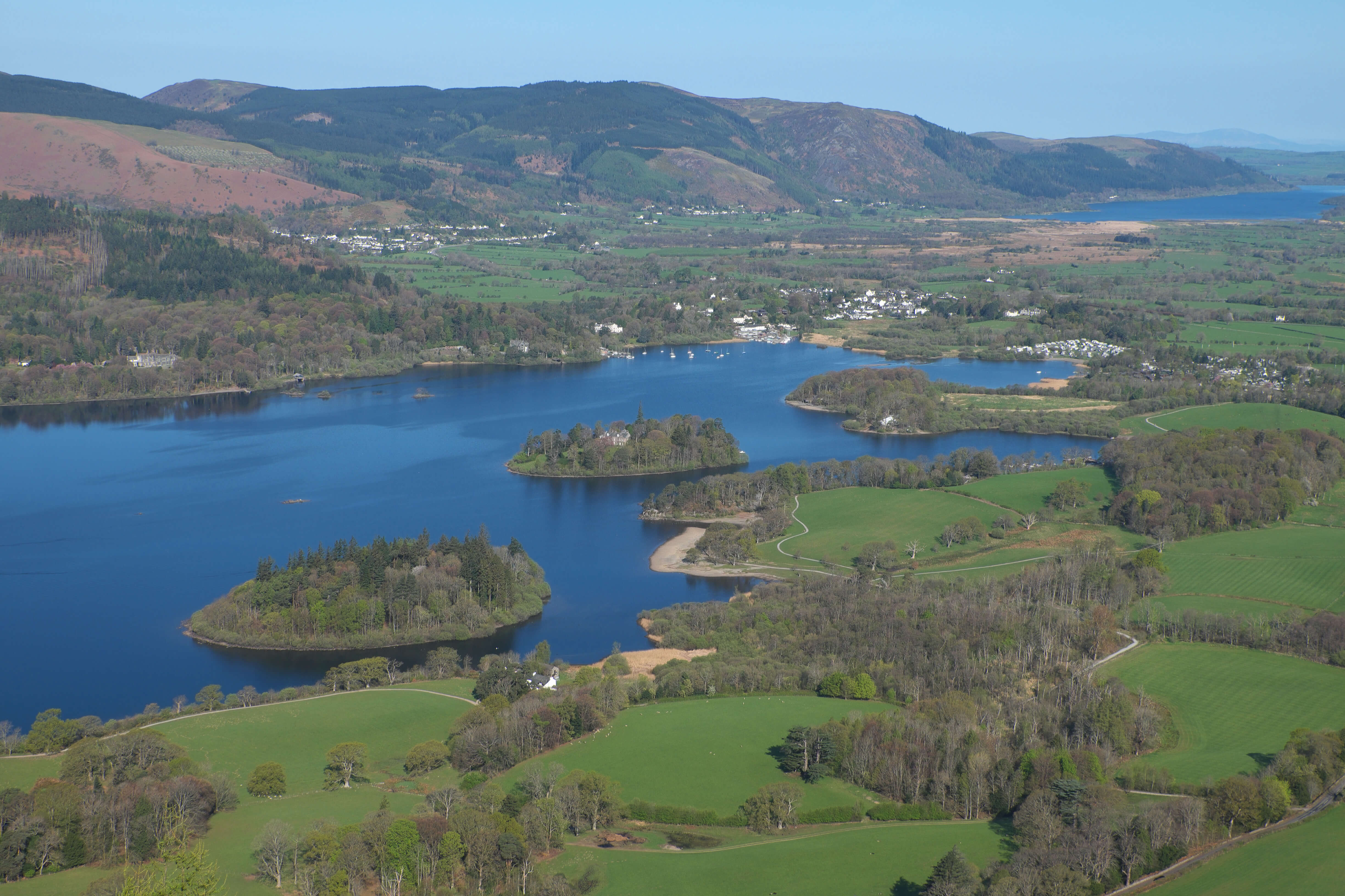
It’s a bit of a slog getting to the top of Walla Crag, but the scene that awaits you at the summit is well worth the effort. Standing on the precipitous edge of this 1,233ft-high crag, you look out over sparkling Derwentwater to the high fells beyond. Skiddaw dominates to the north and, in the misty distance, the Scottish hills can often be seen. From the bus stands in Keswick, head through the middle of town and out to Springs Road, from where a good path climbs steadily through bluebell woods. Out on the open fell, the ascent steepens for that final pull to the top.
The return route heads into the confines of Cat Gill and then through the ancient trees of Great Wood before emerging on the shores of Derwentwater. On the gentle waterside stroll back into Keswick, take some time for a short detour to the end of Friar’s Crag for another breathtaking perspective on this dazzling ‘Queen of the Lakes’.
Walk 6: Hay Stacks
Bus route: Honister Rambler 77/77A, from Keswick to Gatesgarth Farm, or 77C, Cockermouth to Buttermere
Length/difficulty: 4½ miles; moderate/ hard; approximately 3½ hours
Map: Ordnance Survey OL4, English Lakes NW
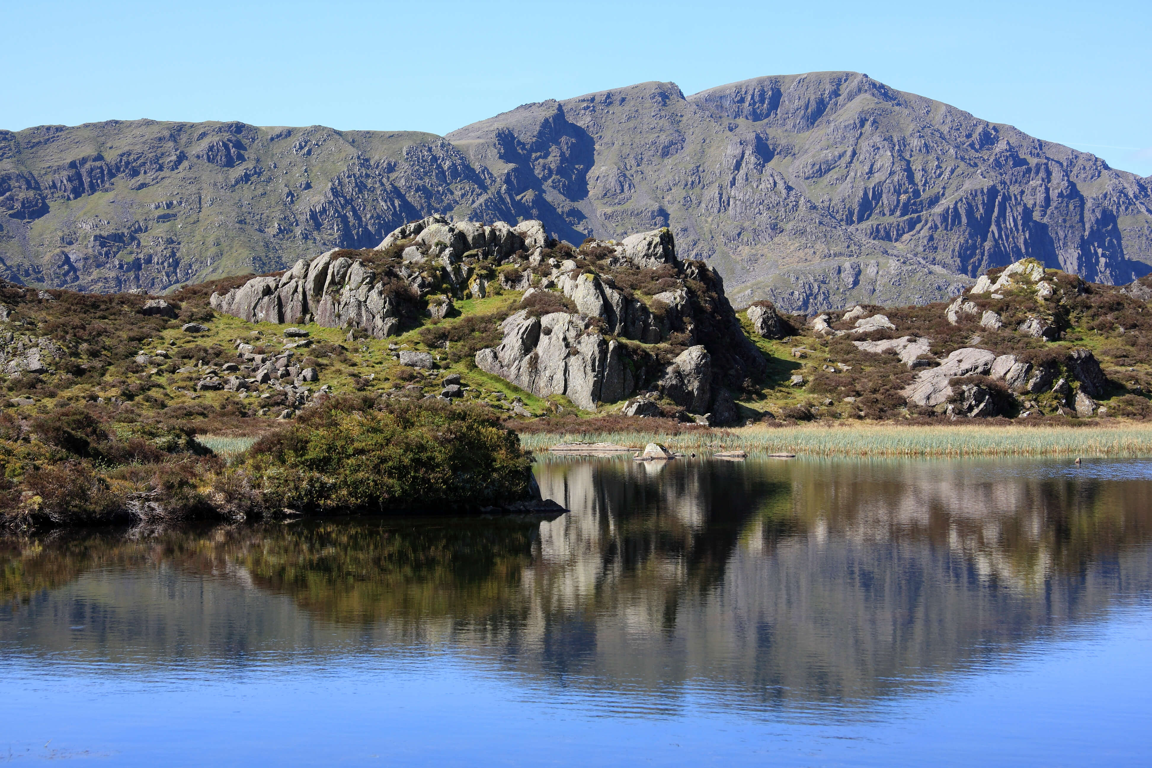
With winter’s snow and ice behind us, now’s the time to head for the more serious tops – but just one of the little ones to begin with…at 1,958ft (597m) above sea level, Hay Stacks may not be the mightiest of mountains, but it has a quality that makes it a favourite among fell-walkers. Once you’ve climbed to Scarth Gap and clambered up the fell’s rough and rocky western slopes, a hidden world awaits. Hay Stacks is all about surprise nooks and crannies, secretive tarns and pools, dark crags and views that change with every twist and turn of the trail. Its bigger, gnarlier neighbours – Great Gable, Pillar and High Stile to name just a few – make their presence felt from time to time, rearing their impressive heads when you least expect them. Having explored the summit, drop back to the bus stop at Gatesgarth Farm via the less well-trodden path on the southern side of Warnscale Beck, paying a visit to Warnscale Bothy along the way.
Walk 7: Great Rigg via Stone Arthur

Bus route: Lakes Connection 555 or Lakesider 599 to Grasmere
Length or difficulty: 6¾ miles; moderate/ hard; approximately 4½ hours
Map: Ordnance Survey OL7, English Lakes SE
This more ambitious walk makes it on to Great Rigg, climbing to the 2,513ft (766m) summit via Stone Arthur. It’s a fairly long climb from the central Lakeland village of Grasmere, but walkers have the choice of keeping almost entirely to grass or clambering up the rocky front of Stone Arthur for a more challenging outing. Once on the high ridge, stride on up to Great Rigg before doubling back and continuing to Heron Pike. This open, windswept section forms part of the Fairfield Horseshoe, a popular fell-walking route that takes in several summits along the ridges curling around the head of Rydal Beck.
The return route uses a less well-trodden trail that drops to Alcock Tarn, a calm body of water hidden in the folds of the hillside. On the steep descent from here to the valley, keep your eyes peeled for red squirrels: these increasingly rare creatures can often be spotted scampering along the tops of dry stone walls in this area.
Walk 8: Ullswater and Wordsworth’s daffodils (linear from Glenridding to Aira)

Bus route: both Glenridding and Aira are served by the 508 and, at weekends and bank holidays, the 509
Length/difficulty: 2¼ miles; easy; approximately 1¼ hours
Map: Ordnance Survey OL5, English Lakes NE
Is there anywhere in England more closely associated with daffodils than the Lake District? And is there anywhere in the Lake District more closely linked with these bright harbingers of springtime than the shores of Ullswater? It was here, after all, that the poet William Wordsworth (or his sister Dorothy, at least) ‘wandered lonely as a cloud’ and spotted ‘a crowd, a host of golden daffodils’. To fully appreciate this beautiful and inspiring part of the National Park, start from the village of Glenridding at the foot of high, rocky fells. The waymarked Ullswater Way heads north, keeping mostly to the lightly wooded lakeshore as far as Glencoyne Bay. Walkers then join a well-constructed path through the wood pasture of Glencoyne, an area that is home to nearly 300 ancient and veteran trees including some magnificent old oaks. The route ends at the 508 bus stop at Aira, where there’s the option of visiting the spectacular waterfall of Aira Force.
Walk 9: Lancaster Canal (linear from Crooklands to Kendal)

Bus route: both Crooklands and Kendal are served by bus 567
Length/difficulty: 8½ miles; easy/ moderate; approximately 3½ hours
Map: Ordnance Survey OL7, English Lakes SE
If you enjoy waterside walks, Cumbria is, of course, the place to be – there are enough lakeshore and riverside walks to keep you busy for years. But there aren’t many opportunities to walk beside canals. The Lancaster Canal Path is one of the few exceptions. From Kendal bus station, catch the 567 (Kirkby Lonsdale) bus, ask the driver to drop you at Crooklands and then join the towpath heading back towards Kendal. Bluebells, wild garlic, lesser celandine, cowslip and other wildflowers fringe the route while songbirds such as chiffchaffs, finches and thrushes call out cheerfully from the trees and blossoming hawthorn. Waterfowl include mute swans, mallards and coots. After the first two miles or so, the water ends but the route of the disused canal is still obvious in the landscape. With views of the Lakeland fells in the distance, the well signposted route continues to Kendal, passing under several humpback bridges and crossing an aqueduct, all left high and dry by the cessation of traffic. The final two miles use a shared cycleway to return to the bus station.
Walk 10: Keswick Railway Path (linear from Keswick to Threlkeld)

Bus route: both Keswick and Threlkeld are served by buses X4 and X5
Length/difficulty: 4¼ miles; easy; approximately 2 hours
Map: Ordnance Survey OL4, English Lakes NW
The once-busy Cockermouth, Keswick and Penrith Railway closed in 1972 but its former trackbed has seen a new lease of life in recent years. Walkers, cyclists, wheelchair users and runners have replaced the steam engines, using the now surfaced path between Keswick and Threlkeld. Set off from Keswick’s bus station and head out, past the museum and art gallery, to join the railway path at the former station, now part of a hotel. As the route passes through the gorge cut by the River Greta, reopened tunnels and old workers’ huts will pique the interest of railway enthusiasts while wildlife watchers will spot a variety of birds and mammals along the riverbanks and in the woods. All around, the natural world is springing back to colourful life after the long winter. Beyond the end of the railway path, walk into Threlkeld for a cuppa in the café or a pint in the pub before catching the bus back to Keswick.
Advice before you set off
Make sure you’ve got a map and are equipped for whatever the weather might throw at you. If you’re heading to the fells, check out the Adventure Smart website for advice.
For information on bus times, go to the Stagecoach website or download the Stagecoach Bus app from Google Play or Apple’s App Store. Pensioners travel free with a NoW card while everyone else pays only £2 per journey under the national fare-cap scheme.
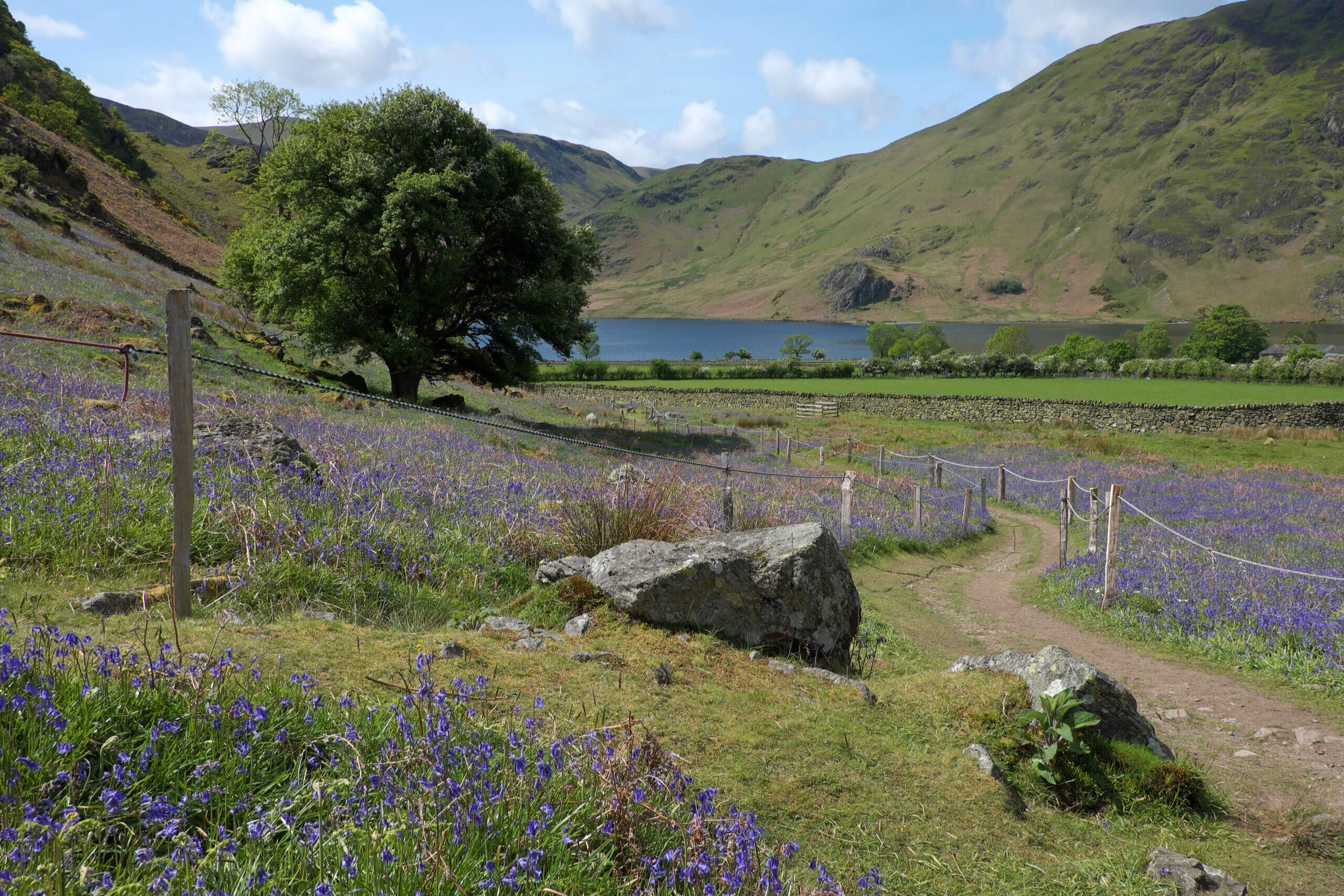
Rannerdale's bluebells
© Vivienne Crow

View from the climb on to Dent
© Vivienne Crow

Path beside St John's Beck
© Vivienne Crow
© Vivienne Crow
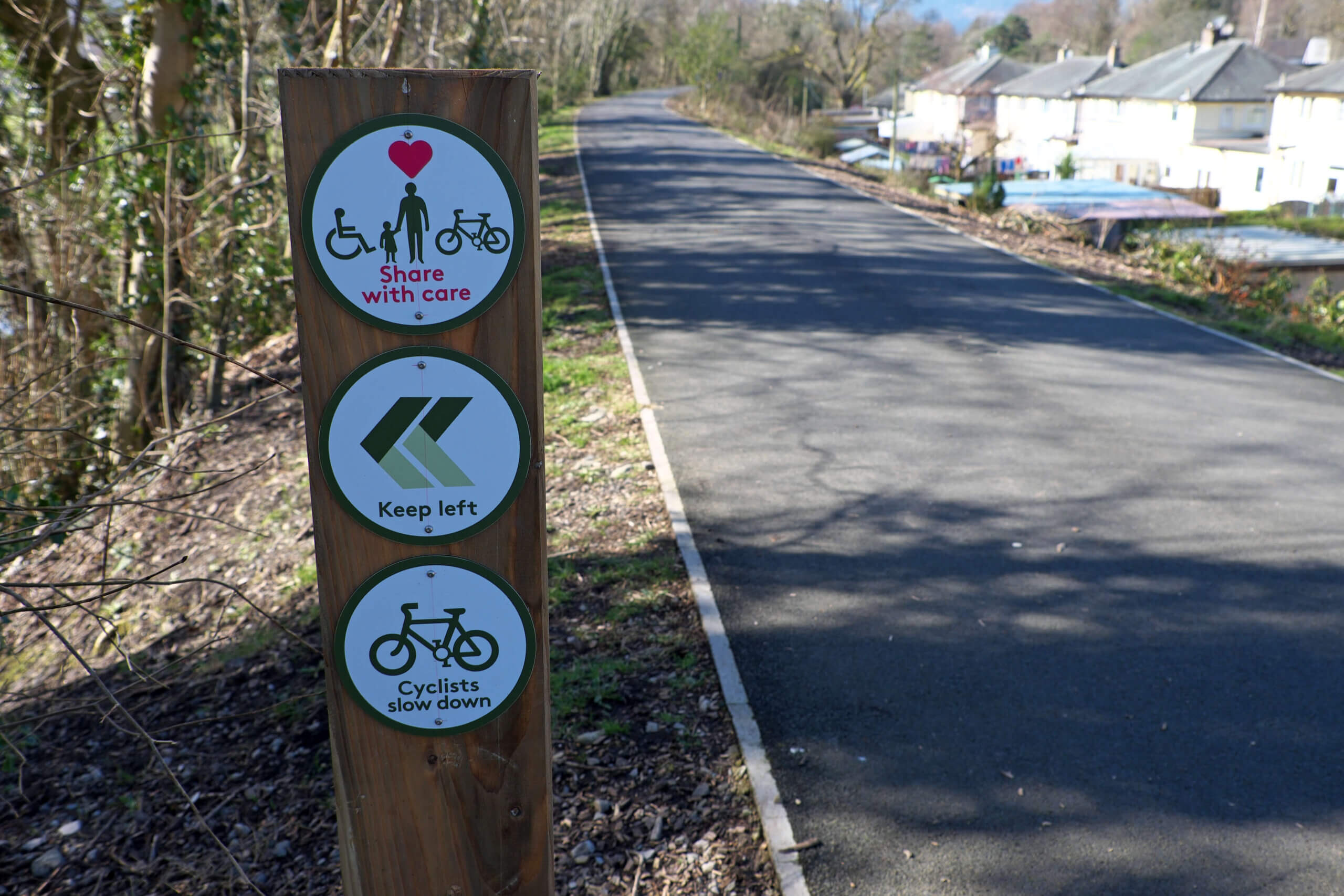
The Keswick Railway Path
© Vivienne Crow
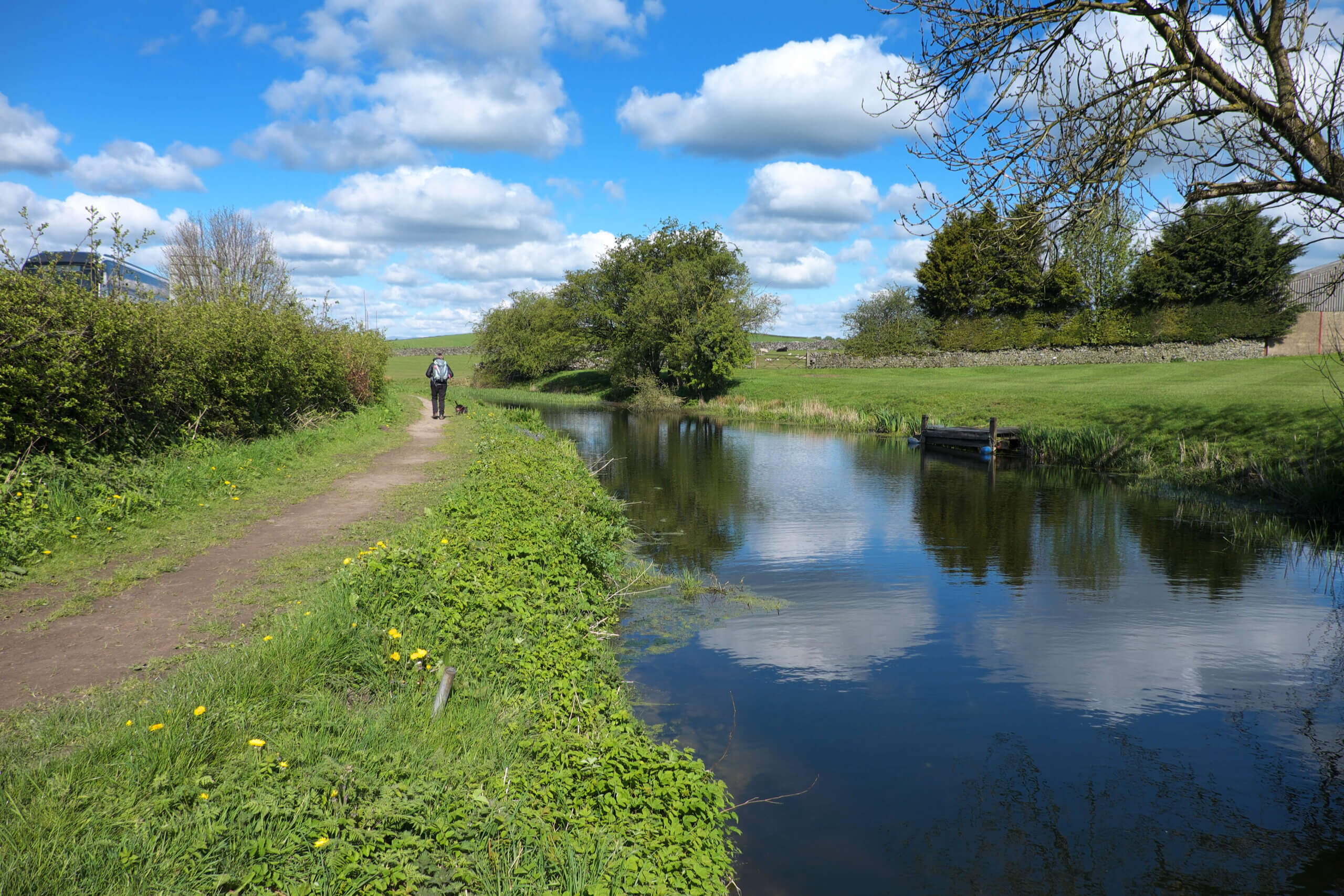
The Lancaster Canal at Crooklands
© Vivienne Crow
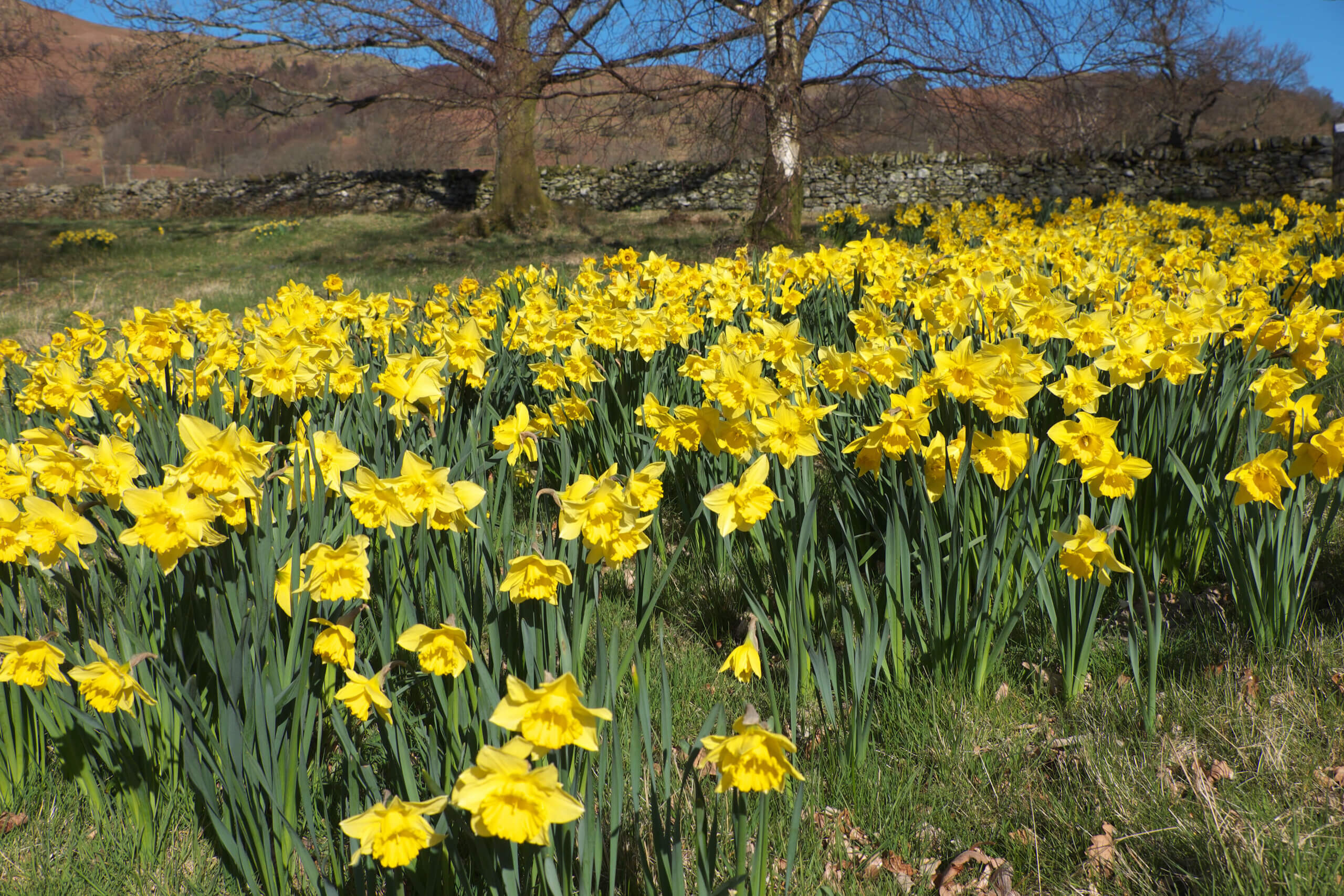
A 'host of golden daffodils' at Aira
© Vivienne Crow
View from Stone Arthur
© Vivienne Crow

Pillar from Hay Stacks
© Vivienne Crow

Derwentwater from Walla Crag
© Vivienne Crow
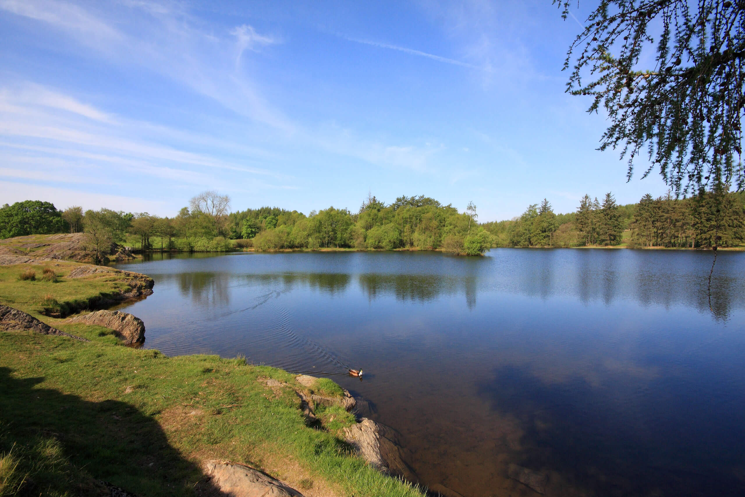
Moss Eccles Tarn
© Vivienne Crow